RETURN TO PREVIOUS INDEX
Canoeing the Noatak River in Alaska in 1989
In the summmer of 1989, Bob Walker (my father), Joan Wrobel (my
wife), and I (Craig Walker) canoed the Noatak River in northwest
Alaska. Bob was 70 at the time and this was by no means his last big
northern trip. Somewhat sobering is that, as I'm writing much of this
web page in 2024, he was 5 years younger than I am now. We had read
that the Noatak would be a small, clear river flowing through the
gravel bars with many easy rapids. What we got was a river in flood
at the start, overflowing its banks, and rather muddy as is typical in
flood conditions. The water fluctuated a lot during the trip - order
a foot up or down overnight each night. We did have a few rapids but
nothing serious. The river was never the clear stream through the
gravel bars that we had read about. We had rain for all but about 3
days out of 3 weeks, which was not good for morale. But we did see
some beautiful and remote country. We were on the river from July 14
through August 1.
As usual for a remote northern river on which you plan to use your
own boats, getting there is half the challenge. The two boats that we
used were my Old Town Tripper, veteran of a number of northern trips,
and a beautiful solo cedar stripper built by Bob before the trip. The
boats were taken north on our 1988 Ford Ranger, putting about 11,000
miles on the truck. Bob drove up from New Mexico, picking up my
sister Jan in Alberta. Joan and I flew to Fairbanks over spectacular
scenery in Southeast Alaska and the Alaska Range. For the trip up the
Dalton Highway, we had 4 people, two boats and nearly a month's
supplies in the small pickup! We drove to Grayling Lake where Bob,
Joan, and I put everything in the boats and paddled out to the middle.
After a while, our charter flight arrived in the form of a Beaver (a
fairly large single engine airplane on floats) from Bettles and picked us
up. Jan drove the truck back to Fairbanks and, after some
vacationing, left it in the airport parking lot. We were supposed to
fly directly to the Noatak, but, thanks to the weather, got to spend a
night in Bettles. We made it to the river the next day, July 14, although
there was just barely enough room under the clouds to get through the
passes.
The story of the canoe trip will be told along with the slide
captions.
We paddled to Kotzebue, a distance of a bit over 400 miles, in 3
weeks. I find it pleasant to spend some time in the northern
communities at the end of trips to learn a bit about the people and
shop for some of the local art. After 2 days in Kotzebue, we flew
back to Fairbanks while shipping the boats as airfreight to Anchorage.
They rode on top of a load of Salmon. From Fairbanks, we drove to
Anchorage to get the boats. We did some tourist sight seeing south of
Anchorage and took a scenic boat tour out of Whittier. We then
returned to Fairbanks with a stop and bus trip at Denali Park.
Finally we put Bob on an airplane home and Joan and I drove back to
New Mexico, taking about 10 days. Joan and I were away from home from
July 11 to August 20. The trips up and back are a part of the
vacation - in fact, for later trips, Joan did not go canoeing, but did
fly up to participate in a somewhat leisurely trip back.
For each photo in this show, the index page has a small version and
a description. You can click on the small version to see a larger
version that about fills a normal computer screen.
I am building this slide show in 2024, 35 years after the trip.
The original photos are on slide film so there is no record of the
exact time and date they were taken. But I have a log of the trip
written at the time which has allowed me to date and locate many of the
photos and has helped with writing the captions.
The photos from this trip were taken with a Konica Autoreflex T3
and a Minolta waterproof camera. The film was Ektachrome of some sort.
The scanning was done on a Minolta Scan Elite in April and May 2002.
I realized recently that I had not made a web version so have done so
in September 2024.
There are no water flow guages on the Noatak listed on the USGS
Site. I found one old paper that claims that the average flow in
August is 27,000 cfs at the mouth. That makes the Noatak, in very
round numbers, twice the volume of the Colorado in the Grand Canyon.
It is not a small river! On the other hand, in winter, there is no
flow in the upper reaches. I made some attempts to measure the
width, depth and speed of the river in the first days of the trip
in the mountains. The resulting flow estimates were a bit under
6000 cfs with very big uncertainties. Of course,
the river grows tremendously between there and the mouth.
Click on the image for a screen size version.
The "2000" and "full size" versions are larger (not available in web versions).
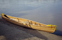
Bob's home designed and built cedar stripper canoe.
|
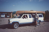
Bob Walker at home in New Mexico on June 30, 1989, ready to start his drive to
Albert to pick up Jan and then drive the Alaska Highway. I'm there to
see him off.
|
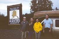
Bob, Jan, Joan, and Craig (me) at the Arctic Circle on the Dalton
(Pipeline) Highway on July 12. Four people, two canoes, and three
weeks of gear for 3 people was a big load for the Ford Ranger.
|
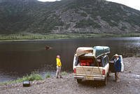
We were supposed to be met by the pilot in the middle
of Grayling Lake beside the Dalton Highway on July 13. When we got there,
a mother and calf moose were wading near the access point. We did not
want to launch while they were there.
|
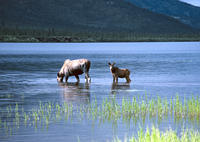
These are the two moose at the launch site. We did not have an alternative
place to launch so we had to wait for them to wander off.
|
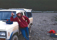
My sister Jan ready to drive the Ranger back to Fairbanks where she would,
after a bit of vacation, leave it at the airport for us to pick up at the
end of the trip. Despite the pose, I'm sure she didn't drink a beer before
the drive - note it is still capped. Note the pipeline in the background -
the Dalton is the pipeline highway.
|
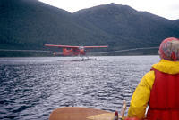
Finally the moose moved on. We loaded the canoes and paddled out onto the
lake. Eventually, Ron Costello from Brooks Range Aviation arrived and
we loaded directly from the boats into the plane. We flew off toward
the Noatak and Jan took the truck back to Fairbanks. Because of the
weather, we ended up flying to Bettles, not straight to the Noatak. We
spent the night in Bettles and made it to the river the next day. Having
flights delayed by a day or two on these northern trips is very common.
|
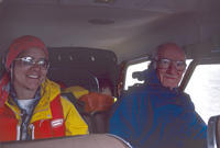
Joan and Bob in the back of the plane on the way to Bettles.
|
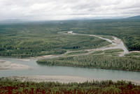
The area of Alaska near Bettles. This is the junction
of the Wind (or maybe John) and the North Fork of the
Koyukuk Rivers. This nice clear water in the gravel bars
was what we expected on the Noatak. But note the rain.
|
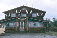
The lodge in Bettles where we spent the night of July 13-14.
|
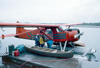
Bob, Joan, and the pilot at the dock in Bettles.
|
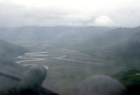
Approaching the put in site at Twelve Mile Slough on the Noatak River
on July 14. The Slough is along the right edge of the valley just
before the final visible bend of the river away from that side. The
clouds were barely high enough to get over the mountain pass and did
not allow much of a view of the Brooks Range.
|
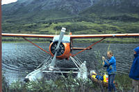
Unloading the plane at our landing site at Twelve Mile Slough.
|
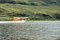
There is a magical moment on these northern trips involving air charters - when
the plane flies away leaving you suddenly alone in the middle of nowhere.
|
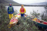
At the Noatak and ready to go. We've just ferried a party
of hikers across the river. Note the near flood conditions
and the lousy weather. This set the tone for the trip.
|
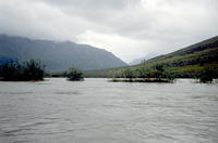
Here it is clear that the Noatak River is in flood. It is also clear why
our views of the mountains early in the trip were a bit limited.
|
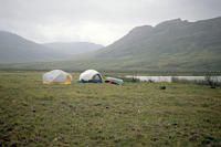
One of our campson the Noatak River, maybe the first which was only about
two miles from Twelve Mile Slew. Until late in the trip, all of our camps
were in the tundra rather than the gravel bars because the gravel bars were
flooded. The river was dropping - by about 1 to 2 feet the first night.
|
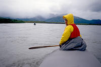
Joan in front of my boat and Bob in the distance on the Noatak River in the
rain. We used spray covers to keep the rain out, help keep warm, help secure
the load, lower the drag in wind, and help prevent taking on water if it
got rough (which basically didn't happen).
|
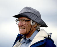
Bob Walker on the Noatak River.
|
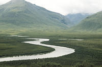
Looking upstream on the Noatak. The logs indicate that we stopped and climbed
a ways up a hill just before lunch. This and the next are probably
among the photos taken there.
|
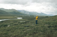
Joan at the hillside stop noted above. Notice the pingo behind her
near the edge of the valley. That is on the 1:250,000 topo map we
were using (which I still have) and indicates we were near Otkurak Creek
|
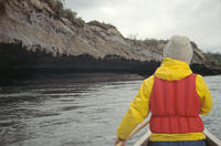
Joan and I paddling past an undercut sandbank. The soft dirt is able to
maintain such a shape because of permafrost holding the upper parts together
while the river thaws and erodes the portion closer to the water surface.
|
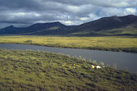
A bit of sun on what I think is our third camp (July 16) near Lake Isiak.
I counted 68 sheep on a nearby hill near bedtime. We are not entirely alone
on this river. There was the group we ferried across at the putin. There
was a couple in Kleppers that we saw from our first camp and met in Kotzebue,
and there were hikers we met near this camp who were expecting to have boats
delivered.
|
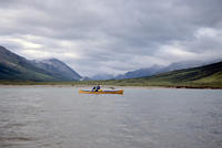
Bob Walker on the Noatak River while still in the mountains.
|
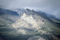
Some mountains near the Noatak River.
|
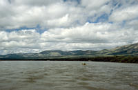
Bob Walker on the Noatak River. The mountains are mellowing somewhat.
|
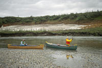
Joan and Bob waiting for me in the boats. Joan trying to fish. Note
the snow field in mid August.
|
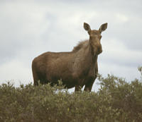
A moose along the side of the Noatak River.
|
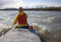
Joan in the front of the Old Town Tripper in a bit of easy whitewater. This
is about as rough as it got if you don't count the ocean waves approaching
Kotzebue. I suspect at the high water level we had, most rapids were washed
out.
|
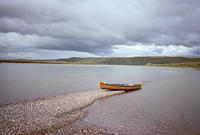
Bob Walker's beautiful cedar stripper canoe pulled out on a gravel bar on
the Noatak River.
|
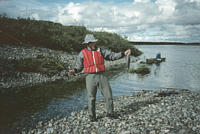
Me (Craig Walker) with one of the very few fish (grayling) that we caught.
The logs indicate that this is early on July 22 and we were at Nanielik River.
After the fantastic fishing we had on the Coppermine River, we hoped for
better. But having the river in flood made it hard. Besides I am a very
inexperienced fisherman. Bob also caught one this day so we had fish for
dinner.
|
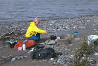
A typical cooking scene along the Noatak River. The two fish are rapped
in foil over the fire.
|
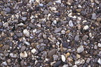
A "textures" photo of the gravel at one of our camps on the Noatak River.
|
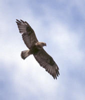
One of the hawks we encountered on the Noatak River. I think it is a
Swainson's Hawk, but am not sure.
|
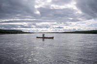
Bob on the river. We're out of the mountains now.
|
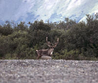
A caribou along the Noatak River at the Nimiuktuk River on July 23. We
camped in this area.
|
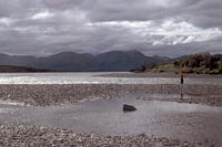
Joan fishing at a side stream.
|
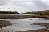
Bob and a caribou on the gravel bar. I think this is the same Caribou as
above at the Nimiuktuk River, where we camped.
|
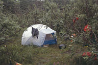
On July 24, we made camp early in poor conditions. The following day was
rain and wind, so we made it a rest day. I'm pretty sure this is the camp
for those two days. We had one stretch of 14 hours of rain with no break.
But the storm broke and July 26 was one of the best yet.
|
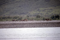
A group of caribou looking to cross the Noatak River near our layover camp.
|
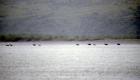
The caribou finally got up the nerve to cross and did so not far from our
camp.
|
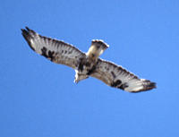
Another hawk. I think this one is a rough-legged hawk.
|
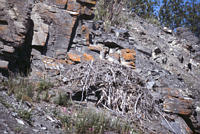
A large raptor nest above the Noatak River.
|
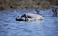
A very curious looking duck scaning for something under the water.
|
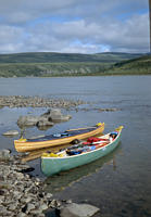
The two canoes along the side of the Noatak River on one of the very few
nice days we had on the trip. This is probably July 26.
|
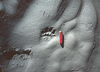
We often found tracks of large animals at our camps. This is one example.
The usual advice is to not camp where there are such tracks, but that would
not have left enough viable campsites.
|
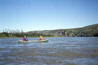
Joan and I in the Old Town Tripper in a photo taken by Bob. For whatever
it's worth, we bought that boat in 1981 and still use it in 2024.
|
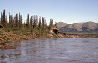
Another embankment showing the undercut structure related to permafrost.
At some point, we started to see an occasional seal. I'm not sure what the
object in the water in the foreground just right of center is, but it could
be a seal, althe the first notes in my log about seals came after Noatak
Village.
|
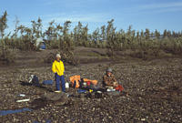
Our camp along the Noatak River. We needed to be careful not to leave anything
close to the water at night because we had water level changes of up to a
foot overnight at times.
|
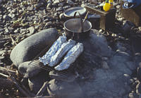
On July 26, at a camp a few miles below the Kalukatvik River, we caught 3
grayling so we each had one for dinner.
|
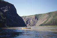
Bob Walker in the Grand Canyon of the Noatak on July 27. There were
some big waves in the rapids in the canyon, but they did not cross the
whole river and could be avoided easily.
|
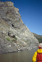
Some interesting geological folding along the side of the Noatak River.
|
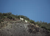
Some Dall's sheep (I think) along the Noatak River. A note in the log
indicates this is in the Noatak Canyon on July 27.
|
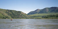
Bob Walker on the Noatak River.
|
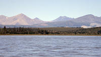
The landscape along the Noatak River.
|
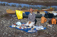
Joan taking advantage of one of our few sunny days to inventory and
sort our remaining food supply. The log indicates this was also on July 27
during one of our only clear days. The first line of the following day's log
says "How could it do this to us!" as we woke to overcast and occasional rain,
yet again.
|
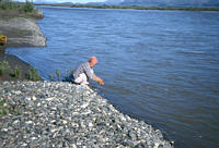
Joan washing something. The river has gotten very big and is in broad, flat
country with some forest.
|
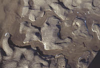
A "texture" photo of some of the mud at camp.
|
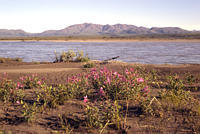
Flowers, the river and the countryside on the Noatak River.
|
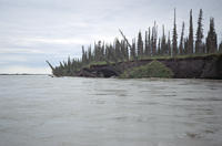
Shore erosion happening before our eyes on the Noatak River.
|
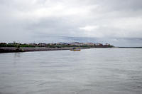
Bob Walker just off Noatak Village on July 29. We spent about 2 hours
in town.
|
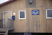
The Noatak post office.
|
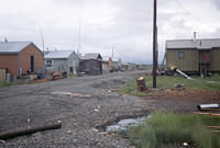
One of the streets in Noatak Village.
|
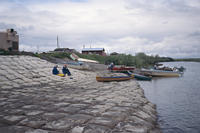
Eating lunch near our boats at the Noatak boat ramp.
|
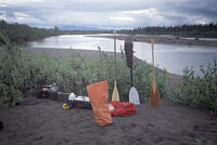
Our camp after the Noatak Village. The river is the main transportation
route between the regional center at Kotzebue and Noatak so we now had
fairly frequent boats going by. Some stopped to chat.
|
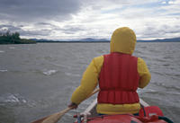
Conditions weren't too pleasant the next day, July 30. The log entry
for the day starts with "WIND.". We were making poor progress so we
decided to wait for it to abate before doing more miles in the evening.
It never stopped so our lunch spot turned into our camp.
|
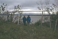
There was a fish drying rack where we stopped.
|
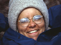
Joan Wrobel in mid "summer" on the Noatak River. Some locals told us that
summer came 2 weeks late and left two weeks early in 1989. It is normally
4 weeks long.
|
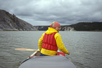
On July 31, we got up at 4 am to try to make some miles before the wind
came up. We passed a fish hatchery run by the state. The wind never really
came up so we kept going, even after the short night sleep. We also passed
a State facility setting up to count salmon with sonar.
|
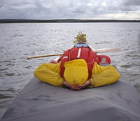
Joan on stike. She claimed her union rules called for no more than 12 hours
paddling and, thanks to the early start and the lack of strong winds, we
were past that.
|
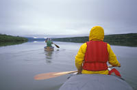
August 1 started with glassy conditions for a change, but still cloudy.
This was to be our last day as we took advantage of the good weather to
cross the Kotzebue Sound.
|
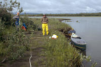
The last landing on the Noatak River before crossing Kotzebue Sound.
The crossing was uneventful and took about 1:20. That had been one of
our big worries about the trip. We did still have quite a distance to
go to get to town, during which the wind came up. The paddle took
2:30 according to the log, and we got to the hotel close to 8 pm.
(Recall it is fairly light all night). We were never far from shore
after the crossing.
|
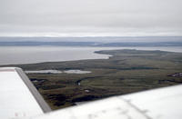
A view from the flight from Kotzebue to Fairbanks of the mouth of the
Noatak in the distance. Kotzebue is behind the wing. This shows most
of our ocean crossing.
|
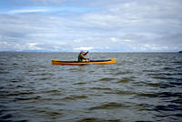
Bob during the crossing of Kotzebue Sound to the peninsula where Kotzebue
is located. We had to cross about 3 miles of open ocean.
As we neared the other side, we suddently changed from
the murky water of the Noatak to Clear water, probably
from the Kobuk.
|
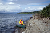
Joan and Bob resting after the crossing of Kotzebue Sound. We still
had several miles to go to get to Kotzebue.
|
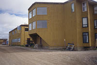
Our hotel in Kotzebue.
|
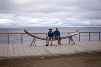
Bob and Craig Walker on the shore of Kotzebue Sound, part of the Chukchi Sea
which is part of the Artic Ocean. This is at the hotel. The water here is
fresh thanks to two very large rivers entering nearby and flowing along
the shore.
|
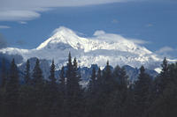
Denali. We are going to Anchorage to get the boats.
|
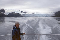
We took a boat tour out of Whittier into Prince William Sound.
There are many glaciers in this area.
|
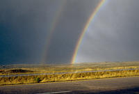
A rainbow in northern New Mexico. Nearly home.
|
RETURN TO PREVIOUS INDEX
I have more photos of Kotzebue and of our travels in Alaska after returning
to civilization, but will not include them here.


