RETURN TO PREVIOUS INDEX
The hike associated with the NRAO 2026 Synthesis Imaging Workshop (SIW) will go from the Water Canyon Picnic Area to the Magdalena Ridge Observatory Interferometer (MROI). Some hikers will stay on the road the whole way while others will use Trail 11 for part of the distance. I (Craig Walker) am the nominal trip leader, working with Anna Kapinski and Rick Perley. The hike is almost entirely within the Cibola National Forest, Magdalena Ranger District.
On the weekend before the hike, May 23 and 24, 2026, I drove the
road to the gate on Saturday with short walks first to take out a tree
down across Trail 11 and then to go beyond the gate to where I could
see the MROI. On Sunday, Joan Wrobel and I hiked Trail 11. During both
trips, I took many pictures. The photos here are a selection to give
an impression of what the hike will be like.
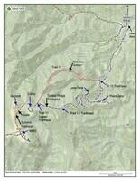
Map of Water Canyon and South Baldy. Many of the locations that are covered in the photos or are of significance for the SIW hike are marked. |
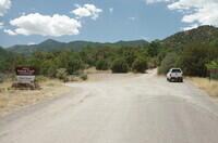
Entering the area of the Water Canyon Picnic Area, which used to be a campground. The picnic area is to the left. The new campground is straight ahead. We may park the bus that brings the students to the hike where my truck is parked in this photo. |
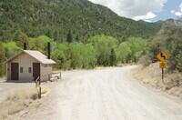
The parking area and restrooms for the Water Canyon Picnic Area. |
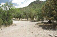
There is a trailhead for the northeastern branch of Trail 13, the Water Canyon Mesa Trail, toward the left side of this picture. It is unmarked. The Forest Service is discouraging, but not preventing, traffic on this trail. It does make a nice loop with the southern branch of Trail 13, which has a proper trailhead. |
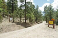
The Trail 13 trailhead. The parking area, with an outhouse and picnic table, is to the right. |
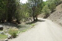
A small pond beside the road. This is often the only water in Water Canyon. Currently, the water is nearly stagnate and it shows. |
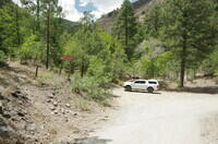
The Trail 11 trailhead. There is room for several vehicles. |
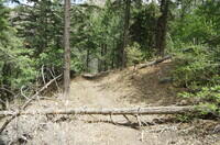
The log over the trail that I removed. As of May 24, there are no more logs across the trail. |
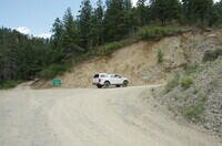
Point Zero. This is the first real switchback on the road. The small road straight ahead goes a short distance to a saddle and the Trail 17 trailhead. Hikers will stay on the main road to the right. |
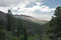
The view down Water Canyon from Point Zero. |
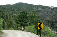
Looking down along the road from Point Zero. The road switchbacks up the hillside above in this photo. Lone Pine is the next switchback which you can sort of make out on the skyline near the right edge of the photo. |
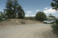
Lone Pine (which is what the sign says). |
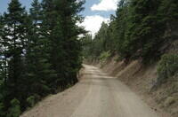
Typical segment of road in the switchbacks above Lone Pine. |
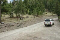
The Trail 14 trailhead. This is a bit beyond the end of the switchbacks and before Timber Ridge. The trail goes to Six Mile Canyon. |
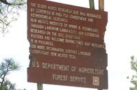
The sign close to the Trail 14 trailhead describing the Langmuir lab research site. Langmuir does lightning research. The astronomy facilities were added later and aren't mentioned on this fairly old sign. |
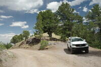
The Timber Peak Trailhead. Trails go to Timber Peak and down along Timber Ridge. This is where the road crosses a saddle in Timber Ridge into the Sawmill Canyon drainage. |
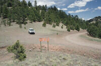
The upper Trail 11 trailhead. Trail 11 drops rather abruptly to the left. |
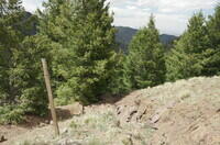
Trail 11 drops down this rather eroded gully. At the bottom of what can be seen in this photo, it levels off considerably and heads to the right down to a big saddle. |
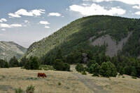
A cow grazing in the meadows that the road passes soon above the Trail 11 trailhead. This is looking across Sawmill Canyon. The main Langmuir Lab building can just be made out on the skyline. |
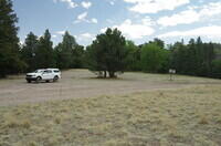
The area marked as Camp on the map. This is a big open area with multiple dispersed camping campsites. The open area extends a considerable distance to the right. The sign warns large vehicles that this is the last place they can turn around before the locked gate. |
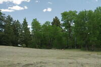
This is the area to the right of the previous photo. This is one of the best dispersed camping sites along the South Baldy road. |
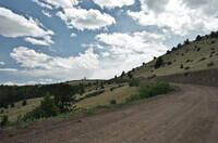
The view along the southeast face of the South Baldy summit looking toward the ridge. The dome is the MRO 2.4m telescope. The MROI is beyond. |
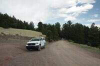
The Trail 8 trailhead with the road heading down through the first bit of forest encountered along the descent. The Camp area is on the other side of this bit of forest. |
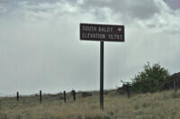
I parked at the locked gate and walked to where I could see the MROI. This is the sign marking the summit trail, which starts shortly behind the sign. The trail is actually a minimal road used to support the research activities on the summit. |
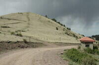
The summit trail trailhead. I have never seen evidence of the guard cabin being used in the 40 years I've been hiking in the area. But it may be used during thunderstorms and rocket launches which are times I would not be there. This photo was taken on the descent when the sun was sort of out. |
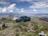
The summit of South Baldy. The whole summit is covered in wire mesh. The white structure is a "kiva" which is basically a Faraday cage. It is used for lightning research by the Langmuir Lab. Occasionally they fire rockets trailing wires into thunderstorms to draw the lightning to a specific spot. Usually there are no vehicles here, but on this day there was a Rivian electric pickup. I did not see the owner. Since I did not go to the summit on May 23, 2026, I am using this picture I that took on July 31, 2025. Note that the VLA is in the background in this photo, but only the maintenance barn is barely visible above the back end of the Rivian beyond the little hill. The antennas at this distance can range from invisible to bright depending on their orientation relative to the Sun. |
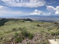
This is another picture from the summit of South Baldy taken on July 31, 2025. It is looking south along the ridge toward MRO. |
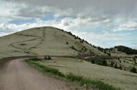
Looking back on the South Baldy summit from near the MRO 2.4m telescope. The summit trail (road) switchbacks up to the left. The gate is just visible on the main road after that road leaves the ridge. The Trail 8 trailhead is about where the road goes off the right edge of the photo. I didn't go to the summit because I didn't trust the cloud overhead not to generate lightning. |
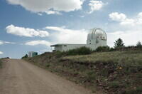
The dome of the MRO 2.4m telescope. The high point of the road is about at that telescope. |
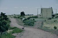
A deer along the road next to the Langmuir Lab balloon facility. |
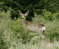
A closer, somewhat cropped, photo of the deer. There were two others in the vicinity. |
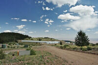
The MROI, the destination of the SIW hike. The two domes are the two telescopes that were involved in the first fringes. The long building to the left houses the delay lines. The main Langmuir Lab building, not visible here, is on the forested hill at the left edge of the photo. |
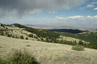
The sun came out for a while as I headed back to the truck. This view is from near the summit trail trailhead toward the low point of Timber Ridge. The road is visible along the left side and at the top of the most distant meadow (where the cows were). The peak in the middle distance above the low saddle of Timber Ridge is Socorro Peak (M Mountain). Socorro is beyond and to the right of that peak. It is visible, but you need the high resolution version of the photo to make out the town. |
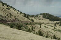
The southeast face of the South Baldy summit with the road. The gate and my truck are visible. |
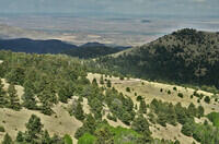
Looking across the Timber Ridge saddle toward Socorro. This might be from the gate. This is the last photo from the Drive up South Baldy on May 23, 2026. |
Hike up Trail 11 with Joan Wrobel on May 24, 2026.
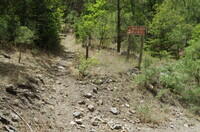
First photo of the hike up Trail 11 on May 24, 2026 with Joan Wrobel. But actually this photo of the start of the trail was taken on May 23. |
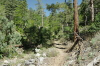
A segment of Trail 11 after it switches to the north side of the stream bed. |
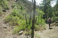
The last stream bed crossing where the trail starts up toward the only switchback. |
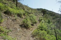
Loking up the hillside from about the same location as the last photo. |
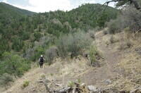
The switchback. This photo was actually taken during the descent. |
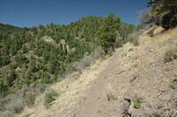
After the switchback. As can be seen, the tread is pretty minimal in some areas. |
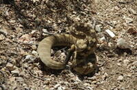
A rattlesnake! I actually walked right by it without being aware of it until Joan called out. I may have been within a foot or so. And it was rattling, although at low volume and I have tinnitus. I convinced it to leave the trail so Joan could come by by lobbing some dirt at it. I can't believe I didn't see it sooner. This is the third rattlesnake I've seen in the Magdalena Mountains in 40 years of hiking in the range. |
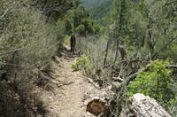
This shows some distinctive logs near where we saw the rattlesnake. The snake was about half way between where Joan is standing and the logs. |
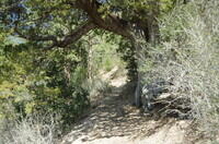
The distinctive, large alligator juniper I call Old Man Juniper, that marks about the half way point of the trail. It provides shade, and a big root to the side is a usable bench to sit. It is a couple hundred yards above where we saw the snake. |
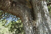
A closeup of Old Man Juniper. The charistic blocky bark is clearly the the reason it is called an alligator juniper. |
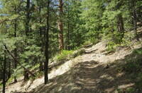
A generic segment of trail in the upper half. |
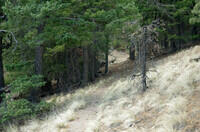
Another generic segment of trail in the upper half. |
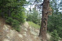
Another segment of trail passing a good size tree with a rather big blaze. Blazes were used to mark most of the trails in the Magdalena Mountains. There are places where they are critical for finding the trail. But they were made long ago, and some of the trees holding them have died and fallen. |
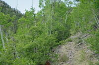
Shortly before reaching the saddle below the last climb to the upper trailhead, the trail passes through a stand of aspens. They make a nice break from the pines. In the fall, they turn yellow and can be very pretty. |
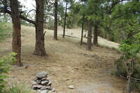
The saddle below the last climb. This photo was actually taken on the descent, but fits the narrative better here. This saddle makes a good lunch spot if the timing is right. |
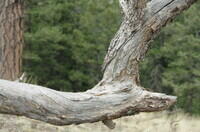
A branch attached to the downed tree where we sat for lunch. |
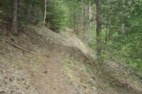
A generic section of Trail 11 in the final climb to the trailhead. |
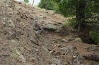
The roughest section of trail. This is just below the trailhead and road. The photo of the start of the trail among the road photos from May 23 is of this same section seen from above. This completed our check of Trail 11 so we turned around. |
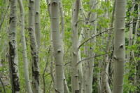
A cluster of trunks of the same stand of aspen trees seen in an earlier photo. |
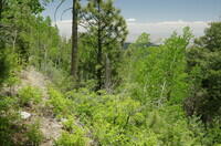
Another of the aspens after the sun came out. |
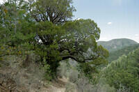
Old Man Juniper during the descent. |
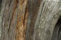
A closeup of a the structure of a dead tree. |
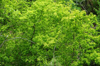
Some very green trees in the bottom of the canyon not very far from the lower trailhead. |
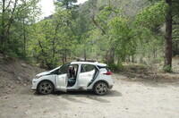
At the lower Trail 11 trailhead. Here is proof you can drive that far with a very low clearance, 2 wheel drive vehicle. This is our Chevrolet Bolt EV with barely over 5 inches of clearnance. We have not taken it above this trailhead, although it would probably make it. When we go higher, we bring the far more capable Ranger. |