RETURN TO PREVIOUS INDEX
This slide set has photos from Joan and my travels around the Southwest in the summer of 1981, 45 years before this show was made. It includes visits to Bandolier, Sandia Crest, Chaco Canyon, the VLA, the Ice Lakes Basin in Colorado, Navajo National Monmument, and the Grand Canyon. The Bandolier photos are from early in summer. I then went to Canada and Washington for climbing. Pictures of those activities a separate show. After I returned from Washington, we went to an astronomy meeting in Albuquerque during which a group from the meeting took the tram up the Sandia Crest. After the meeting, Joan, Susan Neff, Tim Pearson and I went to Chaco Canyon, spending at least one night there. We then went to the VLA where Joan and I were involved in some observing projects. Finally Joan and I went to Colorado and northern Arizona for some hiking.
This trip was of long term significance because Joan and I became more than friends during the trip and have been together ever since.
The photos were taken with my Konica Autoreflex T3 on Kodachrome film.
They were digitized in January 2026 using a Pentax K5 DSLR with a 100 mm
macro lens.
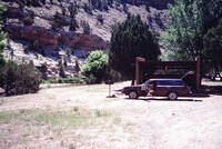
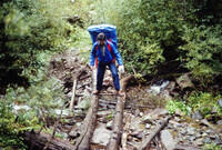
Camping by a river somewhere, maybe along the Rio Grande north of Santa Fe. |
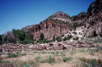
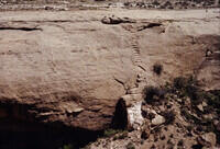
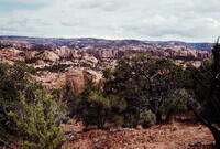
Bandolier National Monument |
Bandolier National Monument |
Bandolier National Monument |
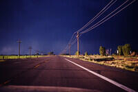
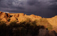
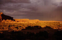
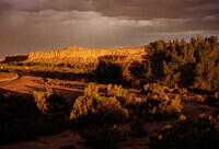
Stormy weather, nice light. Not sure where. |
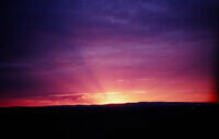
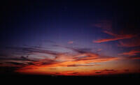
Sunset |
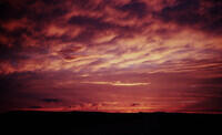
Sunset |
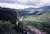
Sluice Boxes State Park in Montana. This is on my way to Canada to visit my sister and go climbing with Hal Murray. See another 1981 show for that trip. Google image search actually identified the location and I confirmed it with Google Earth and other photos. |
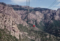
I'm now back from the climbing trip. On a day off at the astronomy meeting in Albuqueque a group of meeting attendees took the ride up the Sandia Tram and did a short hike along the Sandia Crest. This is the Sandia Tram, about half way up. |
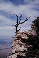
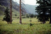
A tree along the Sandia Crest. |
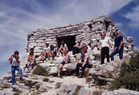
This photo (but different digitization) was published in the "From the Archives" section of the Jan. 2026 NRAO Newsletter with the following caption: In 1981, 200+ astronomers converged on Albuquerque, New Mexico, USA, to share their latest theories and observations of extragalactic radio sources. This conference, IAU Symposium 97, featured early results from the VLA, which had been dedicated the previous year. Mid-conference outings included hiking the Kiwanis Cabin Trail atop Sandia Crest. Astronomers resting at the Cabin include (left to right) Bob Fosbury, Andrew Wilson, Joan Wrobel, Wil van Breugel, Linda Dressel, Lorenzo Zaninetti, Richard White, Tim Heckman, Qifeng Yin, Robert Laing, and Jeff Puschell. Bob is photographing the photographer, Craig Walker. |
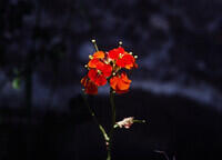
A flower - a western wallflower according to Google. |
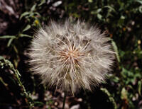
Google AI says it is a yellow salsify plant, also known as a western salsify, goat's beard, or wild oysterplant. |
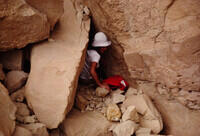
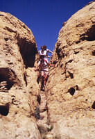
Joan on a tight trail at Chaco Canyon. |
Close to the ruins at Chaco Canyon. |
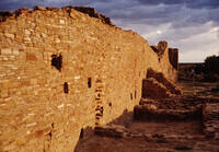
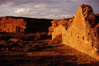
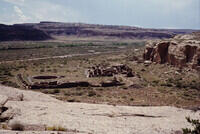
Chaco Canyon. Pueblo del Arroyo. The wall is also seen in second picture below where there is a definite confirmation of the location. The person in the distance is Susan Neff. |
At Chaco Canyon. Pueblo del Arroyo. Have Google Earth match. |
At Chaco Canyon. Pueblo del Arroyo. Have Google Earth match. |
At Chaco Canyon. Pueblo del Arroyo. Have Google Earth match. |
Tim Pearson at Chaco Canyon. Pueblo del Arroyo. Have Google Earth match. |
At Chaco Canyon. Pueblo del Arroyo. Have Google Earth match. |

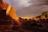
At Chaco Canyon. Pueblo del Arroyo. Light suggests this is close in time to the last few photos so it is in the same place. |
At Chaco Canyon. Pueblo del Arroyo. Have Google Earth match. |
At Chaco Canyon. Pueblo del Arroyo. Have Google Earth match. Light color bricks are in the same places. |
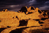
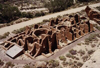
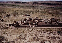
At Chaco Canyon. Pueblo Bonito. Have Google Earth match. |
At Chaco Canyon. |
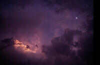
The Moon and clouds. |
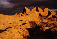
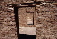
At Chaco Canyon. Probably in Pueblo Bonito based on next photo. |
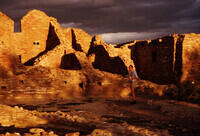
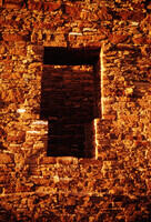
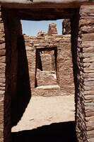
At Chaco Canyon. Doorways in Pueblo Bonito. Found matching photo on the Internet. |
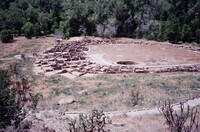
At Chaco Canyon. Kin Kletso. We hiked the Pueblo Alto Loop Trail which goes from Kin Dletso to Pueblo Alto and the Jackson Stairway. |
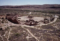
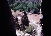
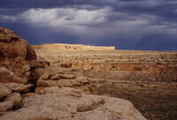
At Chaco Canyon. Pueblo Bonito seen from the Pueblo Alto Trail. |
Susan and Tim on the cliffs above Chaco Canyon on the Pueblo Alto Trail. |
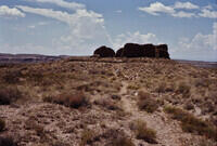
At Chaco Canyon. Nuevo Alto, a small ruin adjacent to Pueblo Alto. On the Pueblo Alto Loop Trail. |
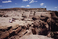
At Chaco Canyon. The Jackson Stairway on the Pueblo Alto Trail. |
At Chaco Canyon. Joan, Susan, and Tim descending back into the valley on the Pueblo Alto Loop Trail. |
At Chaco Canyon. Chetro Ketl from the Pueblo Alto Loop Trail. |
At Chaco Canyon. Another view of Chetro Ketl from the Pueblo Alto Loop Trail. |
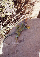
A collared lizard. This is most likely at Chaco Canyon although the next photo I took (not in the set) after the two of the lizard was elsewhere in northern New Mexico. |
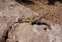
Another photo of the collared lizard. |
Heavy rain at the VLA. |

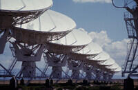
The VLA. Normally all antennas would be pointed the same direction. But here I see at least four pointing directions. |
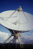
A VLA antenna. |
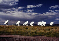
Eight of the nine antennas on the VLA east arm in the D configuration (smallest). |
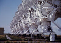
Eight of the nine antennas on the VLA west arm in the D configuration. There are nine antennas on each arm but one is near where the photo was taken and is not seen. |
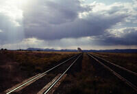
Looking west down the east arm of the VLA in stormy weather from NM 52. |
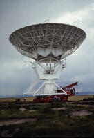
A VLA antenna being transported from one pad to another. Here they are preparing to change from the main line to a spur which involves rotating the bogies. |
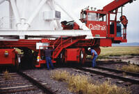
Rotating the bogies by 90 degrees to make the change from the main line to the spur to the pad. |
The VLA in evening light. |
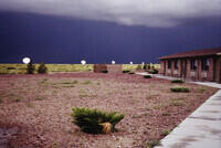
The VLA east arm and the Visiting Scientist Quarters with a storm. |
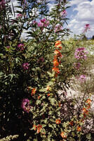
Flowers at the VLA |
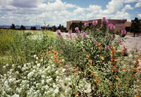
More flowers at the VLA. |
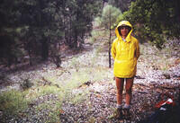
While at the VLA, Joan and I went for a hike in Copper Canyon in the Magdalena Mountains. We got hailed on! |
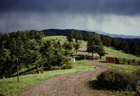
On top of Mt. Withington just south of the VLA. There is a fire tower on the summit. |
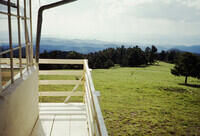
We visited the fire tower. This is the view from the level of the cabin. |
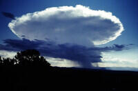
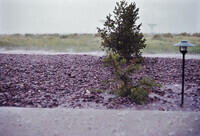
An interesting, compact thundercloud. I'm not sure where. |
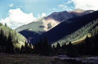
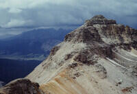
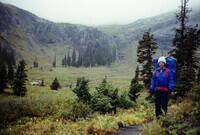
This is the start of the Colorado slides. The view of Bear Mountain from near South Mineral Campground. This is close to Sliverton. |
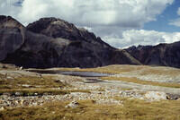
Somewhere between South Mineral Campground and Ice Lakes. |
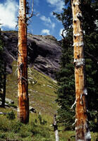
Closeup of a tree somewhere between South Mineral Campground and Ice Lakes. |
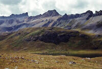
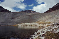
Ice Lake and the mountains around Ice Lake Basin in the vicinity of Silverton CO. |
Ice Lake from a bit uphill. |
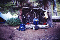
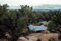
Our backpacking campsite somewhere near the Ice Lakes basin. There are no trees at the level of Ice Lake so this must be somewhat downhill. The shelter was not built by us. |
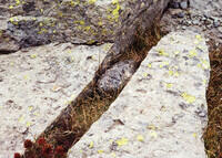
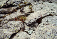
A ptarmigan between rocks. |
Three ptarmigan. |
Fuller Lake in the Ice Lakes Basin. |
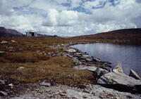
Fuller Lake looking back. The cabin, or it's remains, are visible in Google Earth. |
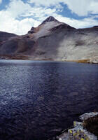
Fuller Lake and Fuller Peak (13,704') in the Ice Lakes Basin. |
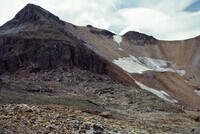
Fuller Peak in the Ice Lakes Basin. |
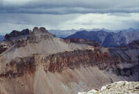
Golden Horn as seen from the top of Fuller Peak in the Ice Lakes Basin. |
Vermilion Peak from the top of Fuller Peak in the Ice Lakes Basin. |
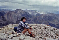
Joan on top of Fuller Peak looking over the Ice Lakes Basin. |
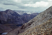
Looking over the Ice Lakes Basin from near the top of Fuller Peak in questionable weather. |
Working our way around a small lake northwest of Fuller Lake in the rain. Google Earth match. |
In the Lower Ice Lake Basin on the trail back down to the trailhead at South Mineral Campground. |
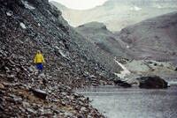
Again in the Lower Ice Lake Basin in the rain. |
Joan crossing a stream on the way back to the trailhead. |
On the way to the Grand Canyon. This is a camp somewhere in the pinon-juniper country. Given the next photos, this might be at Navajo National Monument. |
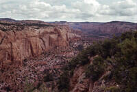
The canyons at Navajo National Monument. |
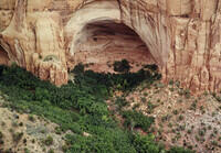
The Betatakin Cliff Dwelling at Navajo National Monument. |
Another view of the country around the Navajo National Monument. |
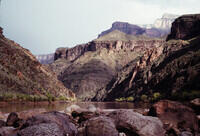
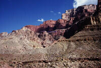
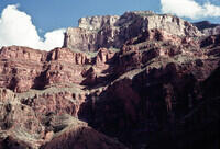
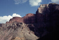
The Grand Canyon. We hiked the Hermit trail to the bottom at Hermit Rapids and spent the night there. The next day, we hiked back up part way and spend another night. On the third day, we hiked out to the car. |
Heading down the Hermit trial. |
Along the Hermit Trail in the Grand Canyon. |
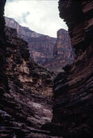
Deep in the Grand Canyon along the Hermit Trail. |
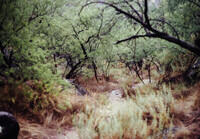
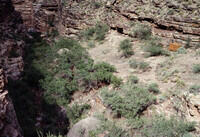
The vegetation somewhere along the Hermit Trail, perhaps at the Colorado river. |
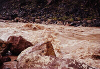
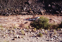
The Hermit Rapid on the Colorado River in the Grand Canyon. In 2008, I rowed my raft through this rapid and all the others in the Canyon. See the photos by going back to the web site index page. |
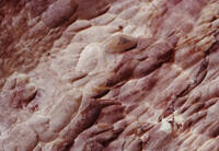
Some of the eroded rock along the river. I'm actually not sure this is right side up. |
Looking upstream from the Hermit Rapid in the Grand Canyon. |
A large commercial motorized raft running Hermit Rapid in the Grand Canyon. |
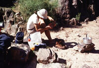
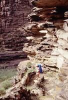
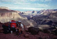
Joan tending to her feet at camp near the Hermit Rapid. |
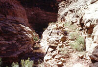
The trail along Hermit Creek in the Grand Canyon. |
Looking toward the rim from the Hermit Trail in the Grand Canyon. |
The camp area where the Hermit Trail joins Hermit Creek. The wooden structure looks like it contains a water pump. |
Looking toward the rim from the Hermit Trail. This is a telephoto shot in the same general direction as the slide before last. |
A similar view from but from a somewhat different angle. The next slide indicates we went out the Tonto Trail so it may be from there. |
Looking across the river. Based on a Google Earth match, this appears to be from the Tonto Trail about half way from the Hermit Trail to where the Tonto Trail overlooks Hermit Rapid. |
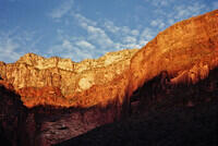
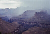
Looking back toward the rim of the Grand Canyon late in the day. |
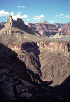
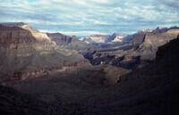
Looking up the Grand Canyon probably from the Tonto Trail near Hermit Creek. |
Sunset picture looking toward the rim from somewhere near Hermit Creek or perhaps along the Tonto Trail. |
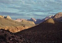
The Grand Canyon from the Hermit Trail well above Hermit Creek on the way out. |
Joan at a rest stop on the Hermit Trail in the Grand Canyon on the way back to the rim. |
A view from the Hermit Trail part way back to the rim from Hermit Creek. |
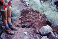
Something very scary happened on the way up the Hermit Trail. We heard noises and looked up to see several boulders falling from the cliffs far above. We watched them land near the trail maybe a hundred yards ahead. When we reached the spot, this is what we found - a large, fresh pit in the trail where one of the rocks had hit. If we had been a few minutes earlier in our hike, .... We didn't linger long in that place. |
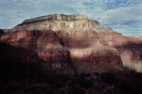
Looking down into the Grand Canyon from high on the Hermit Trail, perhaps at the rim. |
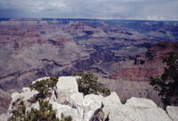
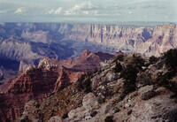
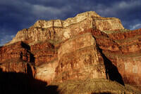
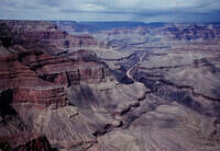
The Grand Canyon from the rim. |
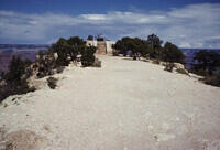
The Powell memorial on the rim of the Grand Canyon. |
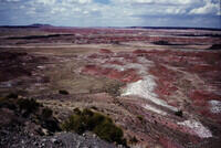
Painted Desert, probably in Petroglyph National Park. I suspect we are on our way back to the VLA. |
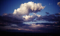
Some interesting clouds. |
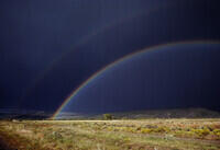
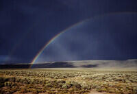
The first of several photos of a great rainbow that we saw on the drive toward the VLA, probably along US 60. |
The intense foot of the rainbow. |
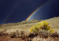
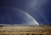
A good shot showing the second rainbow with its reversed colors. |
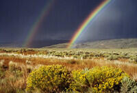
Another of the full rainbow. The bright scattering inside the rainbow is obvious. |
The other side of the rainbow. |
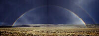
Crude combination of last two photos to show the whole rainbow. |
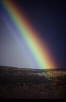
The very bright foot of the rainbow on the right side. |
A sunset on the way back to the VLA. |