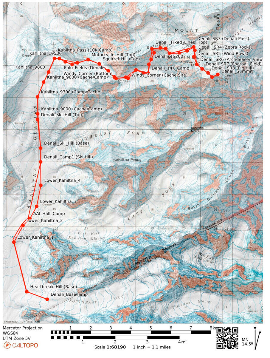
This is a modern map found at
https://caltopo.com/p/D4NEA
showing the West Buttress route. The full interactive caltopo map is
at
this link. We camped at or
near places marked Denali_Camp1, Kahiltna_9800, Denali_11K_Camp (Next
dot below Motorcycle_Hill (Top)), Denali_14K_Camp, and Danali_17K_Camp.
On the way down, we used the 17K and 14K camps and sites at about 9500
ft and 7500 ft on the Kahiltna. See the web site to see more labels
that appear when you zoom in.
Digitized from film. Digitization information:
Date: -
File: wcaltopo.p.D4NEA_G.jpg
Camera: - -- Lens: - at - -- Exposure: - f/- ISO -