RETURN TO PREVIOUS INDEX
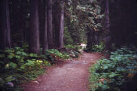
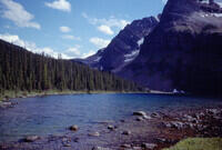
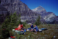
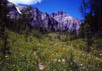
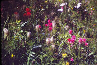
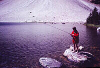
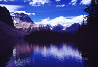
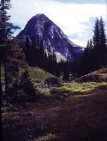
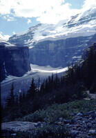
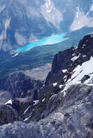
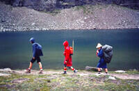
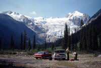
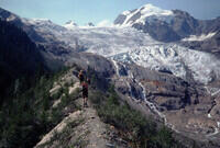
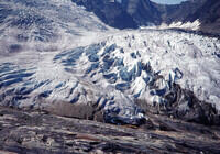
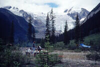
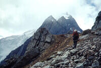
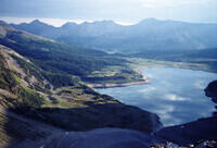
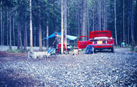
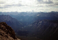
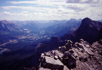
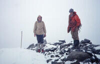
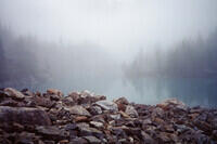
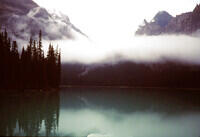
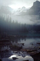
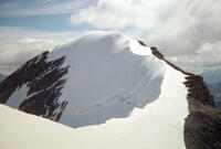
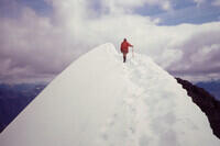
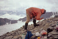
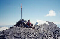
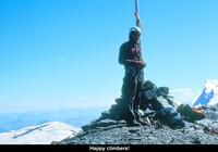
In the summer of 1979, a group of friends with MIT Outing Club traveled to the Canadian Rockies for hiking and climbing. For the first two weeks of the trip, the crew was Bart DeWolf, Mary Lou Welby, Randy Bryant, Barbara Nichols, Dick Flower and myself, Craig Walker. We started with a backpack in the Twin Lakes and Egypt Lake area of Banff National Park. On one of the days, we climbed high on the side of Mt. Scarab above Mummy Lake. We then climbed Mt. Temple in the Lake Louise area. For the climax of that part of the trip, we set our sights on Commander Mountain in the Purcell Range of British Columbia. We camped along Farnham Creek after a 35 mile drive on barely passable logging roads. We then did shorter hikes to the Commander Glacier (twice) and to the Lake of the Hanging Glacier. Finally Bart, Mary Lou, Randy, and I made a successful summit bid, including both glacier travel and interesting scrambling along a high ridge. Meanwhile Barbara and Dick climbed a high ridge above camp.
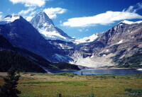
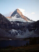
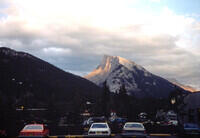
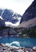
Bart and I were the only ones who stayed for a second two weeks. During that time we got to the Hind hut on Assiniboine. We had planned to climb Assiniboine, but Bart had a weak ankle he had twisted on the Commander ascent and we opted for the much easier Mt. Strom. After return to civilization, I climbed Mt Rundle near Banff, I think solo while Bart recuperated. Rundle is easy and popular so is a good choice for a solo climb. Next reached the main ridge of Mount Victoria above the Abbot Hut, where we spent the night. We did not go along the ridge to the summit because of weather. From there we went to Mt Athabasca where we had a fine climb on the Silverhorn route. We finished off the week with a very rewarding climb of the East Ridge of Mt Edith Cavell. On our last day, we did a short hike to Kinney Lake on the the approach route to Mt. Robson.
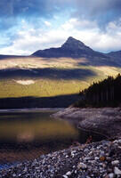
For many of the images, my memory needed help identifying the location. The trip did take place 46 years before I digitized the photos and made this web page. In most cases, I have been able to identify where the photo was taken by looking for matches in Google Earth, Google image search, and other Network information. Usually identifying nearby mountains and lakes was the key.
Bart looked over a draft of this photo show and helped me remember many aspects of the trip. He also provided a copy of a letter that he wrote at the time describing the trip while memory was fresh and gave me access to his slide show about the trip (very nice). That helped a great deal. Thank you Bart.
The slides presented here were taken on Kodachrome film using a
small range finder camera, most likely a Rolei 35S that I had
purchased the year before. They were digitized using a home-brew
setup involving the slide holder from an old film-era slide copier, my
Pentax K-5 DSLR with a 100mm macro lens, and a piece of slotted angle
iron to mount it all on. The digitization was done in September 2025.
Any EXIF data on the photos will be for that event, not the original
photography which was entirely analog. Two of the images, that show
me, were provided by Bart DeWolf in Sept. 2025.
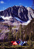
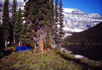
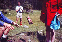
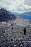
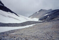
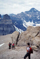
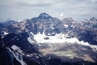
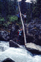
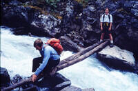
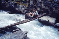
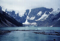
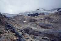
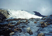
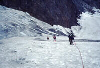
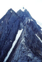
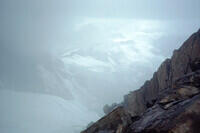
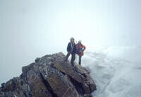
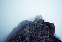
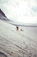
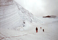
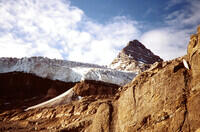
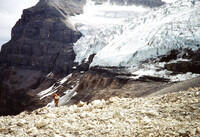
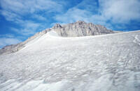
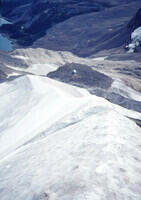
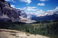
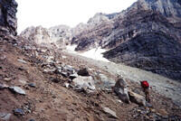
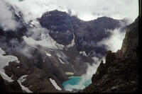
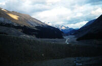
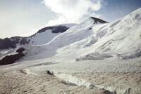
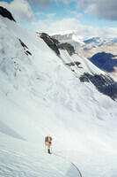
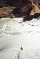
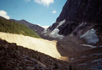
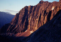
We next set our sights on Commander Mountain in the Purcell Range
of British Columbia. We drove about 35 miles on rough logging roads,
eventually along Farnham Creek, to get within striking range of
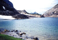
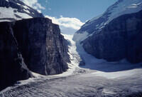
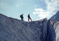
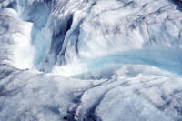
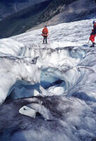
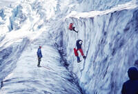
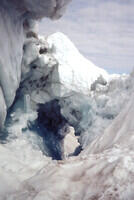
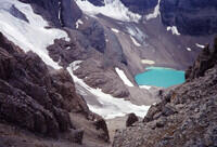
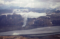
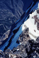
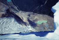
Commander Mountain. Deducing from the photos, we spent one day hiking
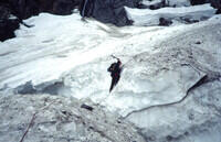
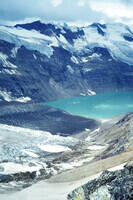
to the Commander Glacier and checking out the ice structures. We also
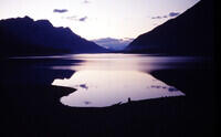
did some crevasse rescue practice. Then we did a hike to the Lake of
the Hanging Glacier, which is in a different canyon and probably
involved driving to a different trailhead. Then we did another hike
to the base of Commander Glacier, perhaps checking out routes.
Finally, on another day, we made our successful summit bid.
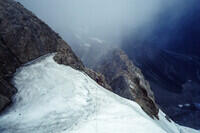
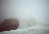
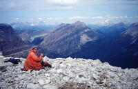
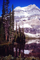
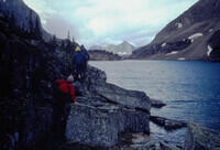
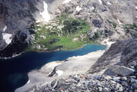
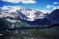
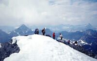
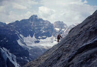
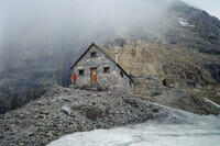
We approached Mt. Victoria from the west, or Lake O'Hara, side
rather than from Lake Louise to the east. This route is not subject as
much to ice and rockfall as the approach from the east. We climbed
the scree slopes to the Abbot Pass hut. There we met some people who
had come up from the Lake Louise side but apparently had little to no
mountaineering experience and really had no business being there. We
also met an older fellow who was alone so we agreed to team up with him
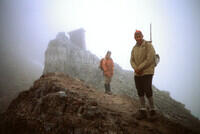
for the summit push. After a night at the hut, we set out for the top.
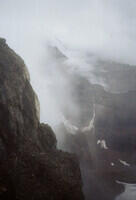
We made it to the long summmit ridge, but a snow storm was in progress
and the fellow we were with did not inspire confidence as I recall. We
made the tough decision to turn back. We did not really want to end
up downclimbing in a lot of fresh snow.
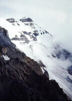
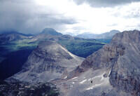
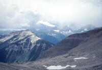
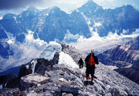
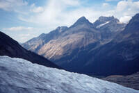
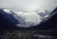
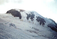
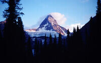
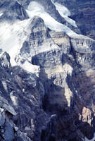
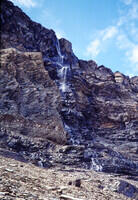
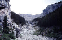
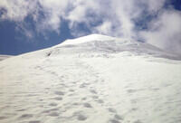
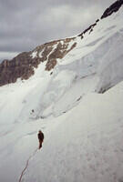
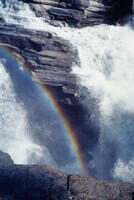
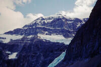
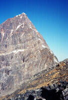
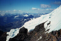
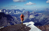
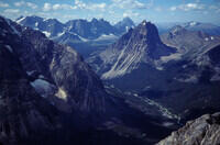
Mount Athabasca is the prominent mountain rising to the southeast
of the main tourist center at the Athabasca Glacier on the Icefields
Parkway. There is a prominent ridge to the right (viewed from the
visitor center) of the summit on Athabasca in the first picture. That was
sufficiently appealing as a snow/ice climb that we went up it rather
than taking the normal route on the skyline to the saddle. It turns
out it is called the Silverhorn Route. We descended on the normal
route.
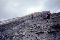
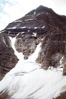
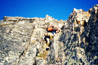
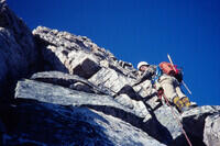
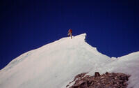
For our final climb, we chose to do the east ridge of Mt. Edith
Cavell. We started from the end of the Edith Cavell road and followed
good trails most of the way to the saddle on the ridge. Unfortunately
we had noisy neighbors in the campground which, combined with our 3 am
alpine start, meant we weren't as rested as we would have liked. One
very memorable aspect of the before-dawn hike was the bright northern
lights which illuminated the trail about as well as a full moon. Most
of the climb is along the ridge with occasional forays to the
side to get around difficult bits. There is one stretch of nominally
5.5 rock climbing on very solid rock (not so common in the Canadian
Rockies) which was probably my favorite part of the climb. We summited
and then descended the west ridge and Verdant Creek basin to the
Astoria Creek Trail which we took back to the road, arriving around dark.
It was a very long day.
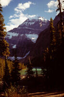
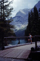
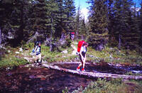
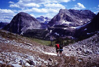
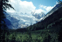
We thought about trying Robson, but did not feel we had the time so
we left it for another year. We never did come back for it. We did
take a short hike to Kinney Lake.