Gila Wilderness Backpack April 2021
Up Next
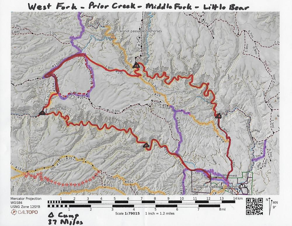
This map shows my hike in red. The original map is at the
"interactive map" link at the web site
https://heartofthegila.org/trail-info/. That map uses an annotated
caltopo.com map to show trail conditions, as indicated by the other
colors. The triangles mark my four campsites. The first, third, and
fifth days were mostly on dry land. The second and fourth days were
following the West and Middle Forks of the Gila River and involved a
large number of river crossings.
Date: -
File: wGila_Overview.jpg
Camera: - -- Lens: - at - -- Exposure: - f/- ISO -