RETURN TO PREVIOUS INDEX
These slides are from a 1981 climbing trip to Canada and Washington State. My companion for the whole trip was Hal Murray. In Washington, we were joined for some climbs by Bob Ayers and Mike Schroeder.
At the start of the trip, I visited my sister Jan at her and Rich's ranch outside of High River Alberta. It sure has grown since then.
We started the climbing trip with a some hikes in the Banff Area. The first is from Moraine Lake to Eifel Lake. Then we went to the Cascade Amphitheater near Mt. Norquay. After that we went to the vicinity of Mt. Asssiniboine. I'm still a bit confused about what we did there as there are photos of what appears to be Marvel Lake, but then there are pictures of the Assiniboine Pass approach to Mt. Assiniboine. Perhaps there were two hikes - a day hike to Marvel Lake and an overnight to Assiniboine. The weather conditions were poor so we didn't do any actual climbing. Our memories of some of the locations visited on this trip are not perfect so, in many cases, I used Google Earth and Google Image Search to try to duplicate the views and identify the camera locations.
After Banff, we went to the Rogers Pass area of the Selkirk Mountains for an attempt on Mt. Sir Donald. The NW ridge is one of the "50 Classic Climbs of North America" (see book by that name). We spent some time camped and doing local hikes in the area. Then one day we set out for a stab at doing the climb in a day. This involves about a 6600 ft elevation gain (numbers from Google Earth), the final 2400 ft of which is easy fifth class climbing on the ridge. We made it part way up the ridge when the head problems I was having about the route, day, and the rate of progress got bad enough that I caused us to turn back. I was partly worried about an uncertain descent. Descending the far side of the mountain was recommended at the time, but is no longer thanks to rock fall danger. Anyway, it was a spectacular day in the mountains even if we backed off.
We then dropped into Washington state and climbed Mt. Shuksan. This was mostly a snow climb. For amusement, we decided to bivouac using bivouac bags rather than tents high on the side of Shuksan. We had an amazing view of Mt. Baker in stormy weather.
Next we were joined by Bob and Mike for a visit to the Enchantments where we did some climbing on very good rock. We climbed the west ridge of Prusik Peak and Dragontail Peak. It is a beautiful area. The area has since become so popular that permits for entry are subject to a lottery.
Finally Hal, Bob, and I climbed the North Ridge of Mt. Stuart, another of the "50 Classic Climbs of North America".
This set ends with some photos of the coast and the Sierra Nevada mountains taken on the way back to New Mexico and the start of various activities based in that area. Note that I had not yet moved to New Mexico at the time. There is another slide set with the Southwest activities in 1981, including Chaco Canyon, Ice Lakes Basin in Colorado, and a hike down the Hermit Trail to the bottom of the Grand Canyon.
These photos were taken 45 years before being digitized and before this web site was prepared. Where I was uncertain of the location of a photo, I consulted with Hal and also used Google Earth and Image Search. Still some locations are still uncertain
I'm not sure which camera I had on this trip. Based on annotations
on one box that included some Sierra photos, it was probably my Rollei
35S. The alternative is my Konica SLR, but that is much bigger and
more awkward to use while climbing. The film was Kodachrome. The
slides were digitized in 2026 using a homemade setup involving a slide
holder from an old film side copier, my Pentax K5 DSLR with 100mm
macro lens, and a Negative Supply Light Source, all mounted on a piece
of slotted angle iron.
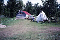
The ranch where my sister Jan still lives with her husband Rich Roenisch along the Highwood River near High River, Alberta. The house has been enlarged significantly and a number of other structures have been added to the property. |
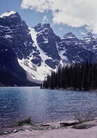
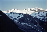
Moraine Lake and the Valley of the Ten Peaks near Banff, Alberta. |
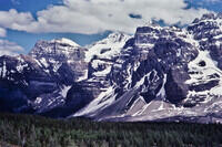
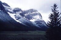
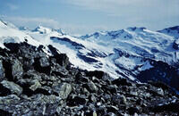
Deltaform Mountain above the trail from Moraine Lake to Eifel Lake near Banff, Alberta. |
The view back toward Moraine Lake and the peaks of the Valley of Ten Peaks |
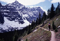
Hal on what looks to be the Eifel Lake trail. |
Eifel Lake looking toward Wenkchemna Pass. |
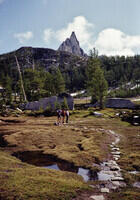
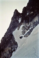
This is the Cascade Amphitheatre with Cascade Peak near Mt Norquay in Banff National Park. The location is confirmed by several nearly identical modern photos found with Google Image Search. |
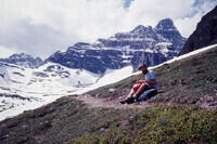
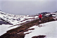
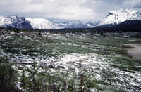
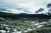
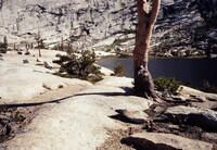
Hal hiking at Marvel Lake. Google Earth and other photos found with in the Internet match reasonably well. His pack indicates that this is a day hike. |
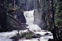
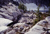
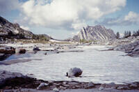
A full stream, possibly the one seen at the head of Marvel Lake in the last photo. |
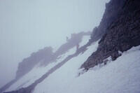
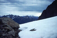
Above timberline somewhere, possibly above Marvel Lake. |
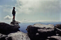
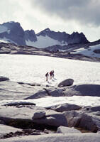
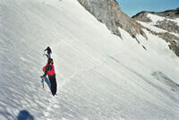
This looks like we're climbing something, but neither Hal nor I remember what. The people ahead of us are presumably another group. |
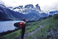
Looking along Bryant Creek in the general direction of Assiniboine Pass. This is presumably on the way to Mt. Assiniboine by way of that pass. Location confirmed with Google Earth. Mt. Cautley is to the left. |
Mt. Cautley above Bryant Creek as seen from the Assiniboine Pass Trail. There is a Google Earth match. This is likely from the hike to the base of Assiniboine shown in the following pictures. This was probably an overnight hike based on Hal's memory and a slide, not in this edited show, that shows a backpacking camp. |
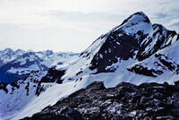
From near Assiniboine Pass, looking east toward Mts Mercer and Allenby. There is a good Google Earth Match. |
Naiset Peak from close to the Assiniboine Lodge. |
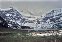
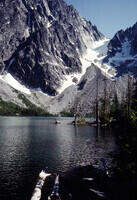
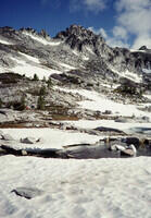
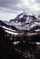
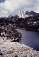
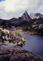
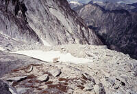
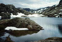
Mt. Assiniboine above Magog Lake. |
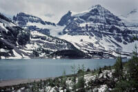
Magog Lake. |
Looking back toward Assiniboine Pass from Lake Magog. |
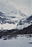
Mt. Assiniboine |
Looking toward Wonder Pass from near Lake Magog. Google Earth confirmed. This is the last slide of the Banff segment of our trip. |
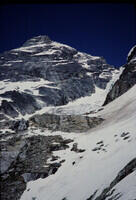
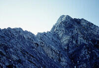
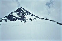
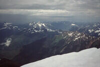
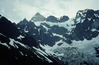
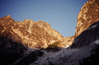
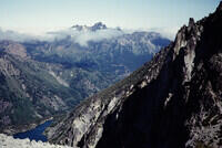
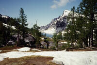
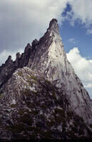
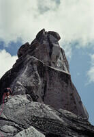
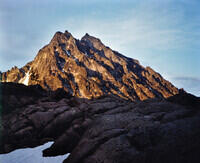
View of Mt. Sir Donald in the Selkirk Mountains of British Columbia. Sir Donald is the sharp peak on the right, as seen from the Trans Canada Hwy west of the mountain. The route we attempted is on the left skyline. The view from this location can be matched on Google Earth. |
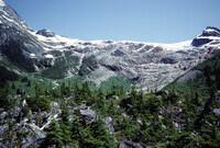
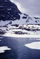
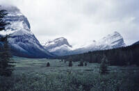
The Illecillewaet Glacier above the Illecillewaet campground where I think we stayed. Mt. Sir Donald is to the left. |
Looking up at Mt. Sir Donald from the approach. The climb is on the ridge to the left. |
Looking back from the approach toward the campground. |
The view from the approach to Mt. Sir Donald. |
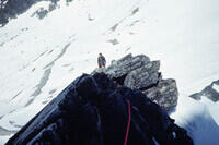
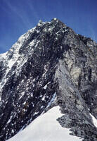
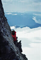
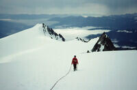
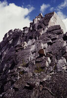
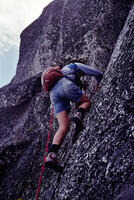
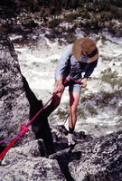
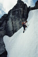
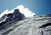
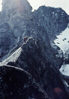
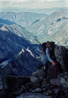
Low on the Northwest Ridge of Mt. Sir Donald. |
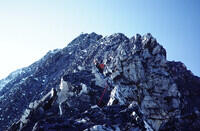
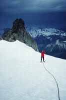
Hal on the Northwest Ridge of Mt. Sir Donald. |
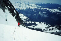
Looking down from the Northwest Ridge of Mt. Sir Donald. |
Looking down along the ridge on the Northwest Ridge of Mt. Sir Donald. |
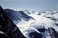
Scenery from the Northwest Ridge of Mt. Sir Donald. |
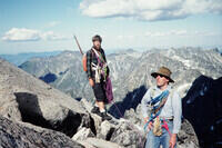
Hal on the Northwest Ridge of Mt. Sir Donald. This may be after we turned around. |
Hal on the Northwest Ridge of Mt. Sir Donald. |
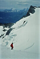
The scenery from the bottom of the technical part of the Northwest Ridge of Mt. Sir Donald. |
Looking up at the Northwest Ridge of Mt. Sir Donald from the Uto-Sir Donald Col. |
Eagle Peak from the approach to Sir Donald. |
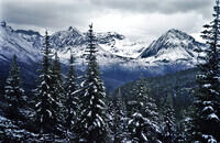
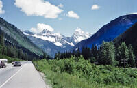
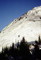
Now we head for the Cascades in Washington State. This is Liberty Bell Mountain along Highway 20 in the North Cascades. The photo matches others on the Internet. |
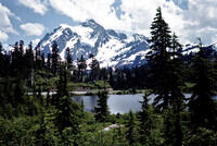
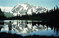
Mt. Shuksan from Picture Lake near Mt. Baker. |
Looking toward Mt. Baker from the west ridge of Mt. Shuksan. This appears to be called the Shuksan Arm. |
This is probably our bivouac site on the west ridge of Mt. Shuksan. |
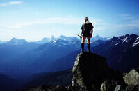
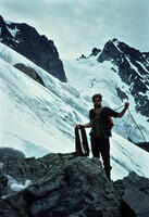
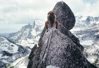
A photo of me on a rock on the west ridge of Mt. Shuksan. This is looking northwest based on Google Earth. |
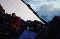
Hal and I bivouacked along the west ridge of Mt. Shuksan. |
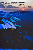
The view from our bivouac site on Mt Shuksan. |
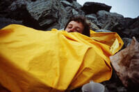
Hal in a bivouac sack. As I recall, we had a storm. |
Mt. Baker from the bivouac site on Mt. Shuksan. |
More of the view from the bivouac site on Mt. Shuksan. |
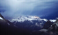
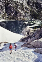
Heading toward the summit of Mt. Shuksan in somewhat threatening weather. |
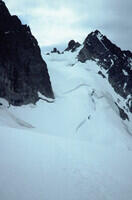
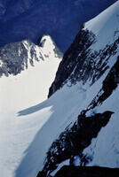
The route we used on Mt Shuksan went through this glacier segment. |
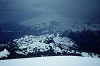
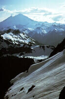
Looking back from Mt. Shuksan to Mt. Baker. |
Looking up toward the summit of Mt. Shuksan. |
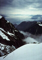
Looking down and more or less east from high on Mt. Shuksan. |
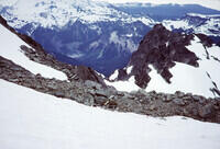
Some high angle rock near the top of Mt. Shuksan. |
Hal on top of Mt. Shuksan |
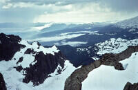
The view from Mt. Shuksan. |
Heading back down from Mt. Shuksan on the upper Sulphide Glacier. |
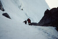
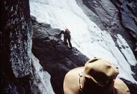
Through the steep section at the Hourglass on the descent from Mt. Shuksan, headed for the Upper Curtis Glacier. |
In the Hourglass on Mt. Shuksan. As I recall, we traverse across the top of the icefall to the ridge beyond. |
Unroping at the ridge after crossing the Upper Curtis Glacier. |
The scenery from below the hard parts of the Mt. Shuksan climb. |
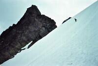
Glissading a snow slope on the way down from Mt. Shuksan. |
Another view down Mt. Shuksan. |
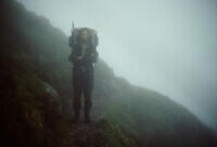
Hal on a foggey trail. Probably still on Mt. Shuksan. |
Mt. Shuksan from somewhere in the general vicinity of Lake Ann. |
Mt. Shuksan from near the ski area, perhaps at Picture Lake. |
On the way into the Enchantments via Colchuck Lake? I don't have a good Google Earth or photo match. |
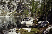
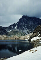
Colchuck Lake in the Enchantments. Google Earth confirmed. |
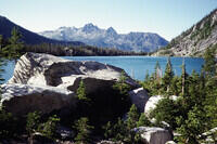
Looking toward the outlet of Colchuck Lake in the Enchantments. Google Earth confirmed. The highest peak in the distance is Cashmere Mountain. |
Probably looking toward Aasgard Pass from Colchuck Lake in the Enchantments. |
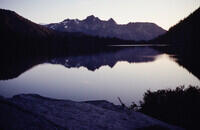
Colchuck Lake in the evening. |
Well above Colchuck Lake looking toward Cashmere Mountain. Probably taken from near Aasgard Pass. |
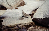
A ptarmigan. A couple of times in my life, I've nearly stepped on a ptarmigan only to get a huge shot of adrenaline when, with great noise and commotion, it got out of the way quickly. |
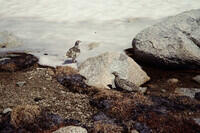
Two ptarmigan. |
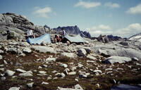
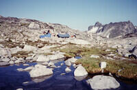
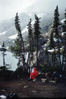
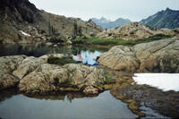
Camp in the Enchantments. |
Hal on top of something in the Enchantments, but it's hard to tell where. It could be Little Annapurna if it is the same place as the following slides. That appears to be Mt. Ranier in the background. |
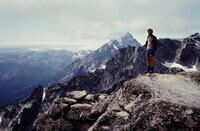
I think this is from the same place as the last photo, but I havn't nailed it down. If it is Little Annapurna as suggested by the following slide, then the high peak just to the left of Hal is Mt. Stuart, which will figure in later slides. |
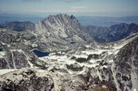
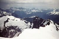
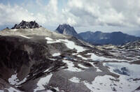
I get a good Google Earth Match if this was taken from the top of Little Annapurna. The lake half cutoff on the left is Inspiration Lake. To its right is Perfection Lake In the distance below the peaks is Lake Viviane and Temple Lake . Much farther below is Snow Lakes. The peaks start with Prusik Peak. A high point is The Temple. |
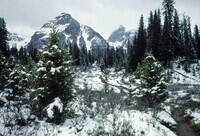
From somewhere high in the Enchantments but the exact location is not clear. |
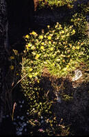
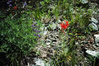
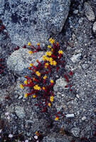
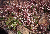
Some flowers in the Enchantments. |
More flowers in the Enchantments. |
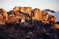
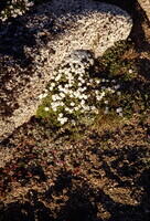
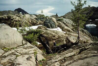
Some boulders in the Enchantments. |
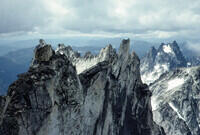
The ridge that starts with Prusik Peak in the Enchantments. The foreground is the area between Inspration Lake and Lake Olrun. Caltopo shows the Snow Creek Backcountry Camping area in the vicinity. |
Somewhere in the same general area as the last photo. |
Hal and Mike descending toward a Inspiration lake in the Enchantments. The shot matches photos on the Internet. |
The shore of Inspiration Lake. |
This is probably Perfection Lake. Ok by Google Earth, and that is the next logical place to go after Inspiration Lake. |
Prusik Peak above the upper end of Perfection Lake. You can see the stepping stone trail in Google Earth. |
Looking back toward Perfection Lake on the way to Prusik Peak. |
The ridge to Prusik Peak. |
Another of the west ridge of Prusik Peak with fine climbing rock. The route is indicated in the middle of the picture by the lack of lichen along a crack. |
Bob climbing on Prusik Peak. |
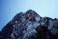
Me leading another part of the climb of Prusik Peak. |
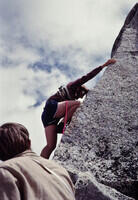
Another of me leading part of the climb. |
Hal standing on a perched rock on the west ridge of Prusik Peak. |
Hal scooting along the sharp ridge near the perched rock on the west ridge of Prusik Peak. |
Bob climbing a corner on the West Ridge of Prusik Peak. Hal is standing above. |
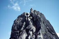
Hal gathering the rope at the top of Prusik Peak with Bob waiting. |
Looking down from Prusik Peak to Lake Viviane and Leprechaun Lake. |
Bob starting a rappel on the descent. |
Back down near Perfection Lake. |
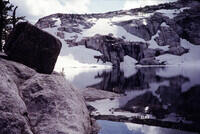
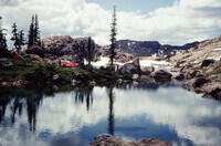
One of the Enchantment lakes. |
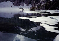
The shore of one of the lakes with partial ice cover. |
Looking back on Prusik Peak over Perfection Lake. |
A similar picture of Perfection Lake to the last, but with different light. |
Probably the outlet to Inspiration Lake. |
Back in the flatish area above Inspiration Lake and below Lake Olrun. |
Heading back to camp over the snowfields in the Enchantments. |
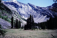
Back at camp. There are still not many clues to the location. From Google Earth, the peak in the background is McClellan Peak. The camp probably is not far from Lake Reginleif which is adjacent to Isolation Lake. |
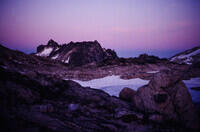
The view in the evening from camp toward McClellan Peak. |
Our camp the next day. This view uphill is about right according to Google Earth for the campsite near Lake Reginleif. |
A mountain goat, probably along the route back toward Colchuck Lake. |
Hal playing on some steep snow somewhere. |
Looking back over the Enchantments from the slopes toward Dragontail Peak. |
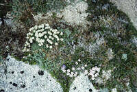
Some Flowers. |
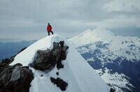
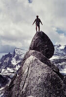
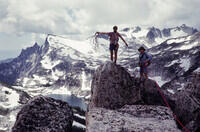
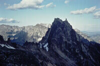
At the summit of Dragontail Peak. Google Earth makes it look much smoother, but other photos on the Internet match this exactly. |
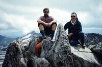
Hal and Mike on the summit of Dragontail Peak. |
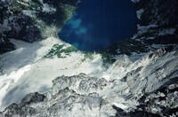
Looking down on Colchuck Lake from Dragontail Peak. |
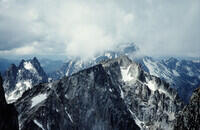
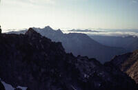
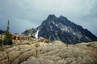
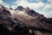
Looking west from Dragontail Peak toward Mt. Stuart, which is in the clouds. |
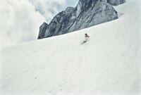
The fun way down from Dragontail Peak. |
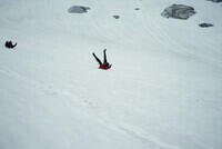
The even more fun way down Dragontail Peak. One slides better on a smooth parka back on low angle slopes. |
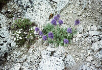
Flowers. |
Back at Colchuck Lake. |
Flowers. |
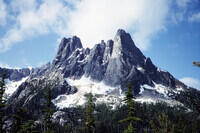
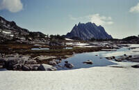
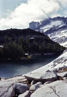
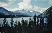
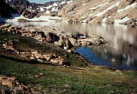
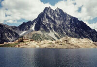
At Lake Ingalls on the approach to the North Ridge of Mt. Stuart. That is Mt Stuart in the background. Lake Ingalls is west of the mountain and the North Ridge is not in view. |
Camp at Lake Ingalls. |
Looking toward the top of Mt. Stuart from Lake Ingalls. |
Lake Ingalls. |
The area around Lake Ingalls. |
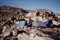
Our camp at Lake Ingalls. Camping that close to the water might be frowned upon these days, but our trip was 45 years ago. |
Late light on Mt. Stuart from Lake Ingalls. |
Crossing the Stuart Glacier to get to the North Ridge of Mt Stuart. |
The normal route is to access the ridge part way up from the Stuart Glacier. Doing the full ridge involved some harder fifth class climbing. This notch is where the ridge is accessed. You can see tracks of previous parties. |
Heading for the North Ridge of Mt. Stuart from the Stuart Glacier. |
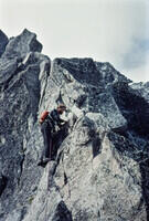
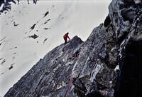
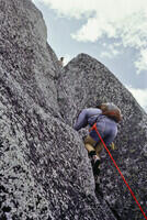
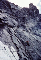
Hal leading on the North Ridge of Mt. Stuart. |
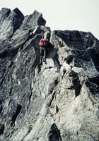
Hal leading on the North Ridge of Mt. Stuart. |
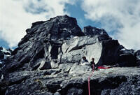
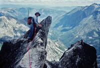
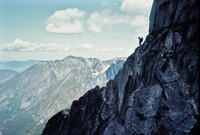
Me approaching a belay ledge on the North Ridge of Mt. Stuart with the Hal and Bob already there. |
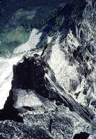
Looking down the North Ridge of Mt. Stuart. A bit exposed! |
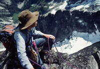
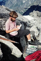
Bob at a belay ledge. |
Hal probably setting a belay above one pitch. |
Hal at the top of a slab pitch. |
Hal and Bob at the bottom of another pitch, presumably led by me. The route is quite clear based on lack of lichen. |
Bob at near the belay spot with Hal still on the ridge below. |
Hal leading higher on the ridge. As I recall we ended up on the snow and there was a tricky mixed climbing move somewhere, but I'm not sure it is in the photos. |
Here we are crossing a snow patch, following old tracks. |
Hal leading beyond the snow patch. |
Hal silhouetted nicely on the ridge. I'm not sure how he got there from where I am taking the picture. It might have been a low traverse and then climb up. |
Bob climbing toward me after I led a pitch. |
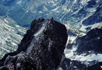
Hal and Bob on, or close to the top of the North Ridge of Mt. Stuart as we are gathering the ropes. |
Hal signing the summit register on Mt. Stuart. |
Looking along the ridge on top of Mt Stuart. The silhouetted object is a rock, not a person. |

Hal and Bob headed down from Mt Stuart. There are a couple of primitive trails marked on maps on the south slopes so I presume that is how we came down. I have no memory of the descent. |
Some flowers. |
Back at our camp at Ingalls Lake. We may have had to climb back up quite a bit from the bottom of the descent to camp. |
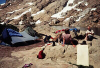
Relaxing at camp after the North Ridge of Mt. Stuart climb. |
We weren't alone at Lake Ingalls after the climb. We don't have a red tent. |
Looking back at Mt. Stuart after the climb. |
This might be looking back up at the descent route from the trail back to the trailhead. |
More flowers. |
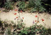
And more flowers. |
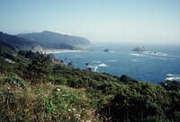
The climbing trip is over. Here we go out to visit the sea on the way to Hal's home in Californ. |
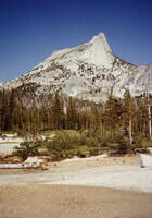
After leaving Hal, I headed back to New Mexico. I drove over the Sierras by way of the Toulumne Pass Road. I did a bit of hiking in the Sierras while there. This is Cathedral Peak from close to Cathedral Lake. |
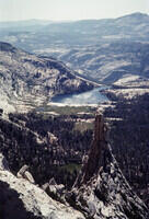
The view from at or near the top of Cathedral Peak over the Cathedral Lakes toward the Toulumne Pass Road. Since I was alone, I probably did not do the final pitch to the summit. |
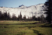
Tresidder Peak from near Cathedral Lakes. |
Cathedral Lakes, I presume. |
Somewhere near the Cathedral Lakes in Yosemite National Park. |
I have no idea what or where this is. But long ago, I saw fit to put it in an edited slide set so I'll leave it for now. |